The Northeast kingdom railroad


St. Johnsbury, Vermont
Web page written and maintained by Mike McNamara
I will be prominently modeling St. Johnsbury, Vermont. It is at the center of my layout, both physically and operationally. It occupies a 3' x 14' section of the center peninsula and feature the trackage of CP, MEC and LVRC, as well as some yard tracks and local sidings. I have included the E.T. & H.K. IDE buildings, the Caldbeck-Cosgrove building, Allen Lumber, and also a freelanced propane dealer. I was not able to fit in the Ralston Purina plant or the turntable, and I have rediced the number of yard tracks. I also did not model the large CP passenger station. This appears to be a quite a challenge, and it would be in my aisle anyway!
Most of the layout operations will involve St. Johnsbury in some way. CP-BM trains pass through, while MEC and LVRC trains will arrive and depart with interchange traffic. Meanwhile, a CP switcher will handle the local industries as well as sorting the interchange cars.
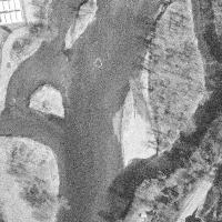
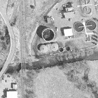
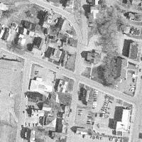
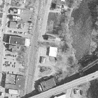
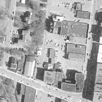
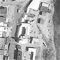
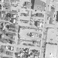
Here is a satellite view of St. Johnsbury yard. The top is North and features the CP Rail track to Newport, with the MEC track curving to the right under the Rt. 2 road overpass. At the bottom is the CP Rail track South to Wells River, with the LVRC curving to the left under a road overpass.
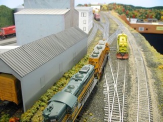
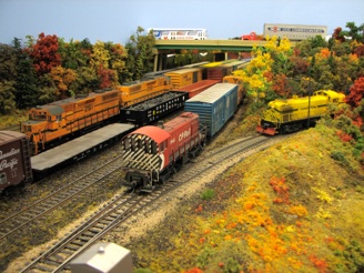
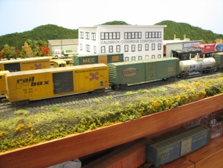
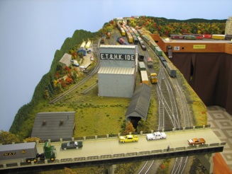
Here are some views of St. Johnsbury yard on my layout. All of the track is in place with scenery mostly complete. Structures and details are still ongoing. Some structures are complete while others are still mockups. I will probably wait until more of the layout infrastructure is complete before getting back to modeling these buildings.
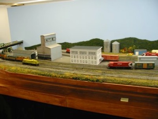
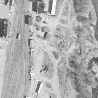
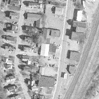
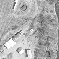
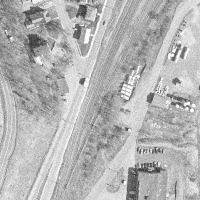
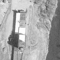
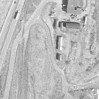
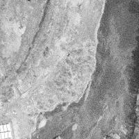
Let's tour the St. Johnsbury yard from North to South with information about the key features. Compare pictures below to the overhead satellite view to find the relative placement of the buildings to the track.

At the north end of the yard where the CP departs to Lyndonville on the way to Newport, this small shanty sits between the CP Rail and MEC tracks before they head under the Portland Street underpass. Little buildings like this are important to add to the layout to add interest. A model would be a basic box painted boxcar red with white door and window castings and trim.
CP Rail Shanty

To the east of the shanty, the MEC track curves off on its way to New Hampshire's White Mountains and ultimately Portland, Maine. The track passes below Rt. 2/Portland Street, useful for hiding the track at the end of the modeled portion of St. J.
Because of how I fit St. J on my layout, the CP track essentially curves this same direction, parallel to the MEC.
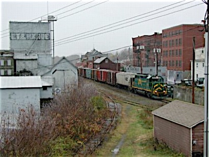
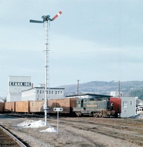
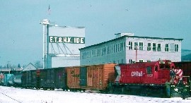
A reverse view of the same area (looking south) helps give perspective to the northern area. this October 2003 photo by Dan Onorevole (via the NERAIL photo site) shows current operator VRS heading north. The shanty and MEC tracks discussed above are visible. The looming E.T. & H.K. Ide building is our next subject (below).
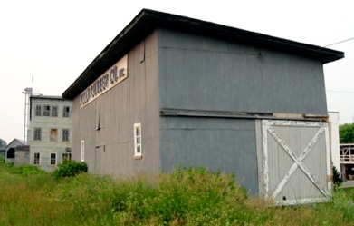
E.T. & H.K. IDE Building
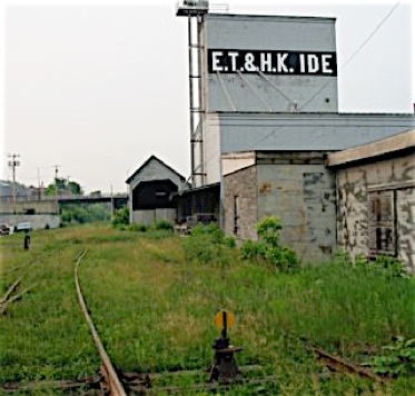
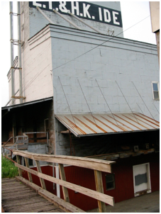
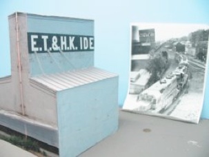
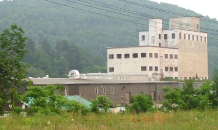
A signature building next to the St. J yard is the E.T. & H.K. Ide building. Through the years farm products were shipped and received from this building. Being so prominent in height and location to the yard tracks, I knew I needed to include a model of this building. There is the large tower building and also the car shed with a siding through it. On the side of the building there is a lower level loading area for trucks. There are also many additions built onto the main building that making an exact replica is a real challenge. I decided I would model a representation of the building that captures the main aspects of the building from the track side.
Marty Phillips from Vancouver took the time to measure the building when he still lived back east. He sent along the following dimensional information for modeling the building:
Main Building
-
•Trackside widths: 52' at base, 15' at tower (as in picture below)
-
•Trackside height: 72'
-
•Tower depth: 52' (side with "E.T. & H.K. IDE")
-
•Sidewalls height: 36'
-
•Sidewalls depth: 100'(i.e. tower only goes back 52' of the 100')
-
•Black Band height: 9' (with lettering inside)
-
•Platform height: 5'
-
•Canopy over platform height: 10'
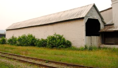
Car Shed
-
•Trackside length: 122'
-
•Trackside height: 19'
-
•End width: 15' (end with track entering)
-
•End peak height: 26'
-
•Roof overhang: 1'
-
•Trim around track opening: 7"
-
•3 Side Windows: 40" x 68" (boarded over in view below)
-
•Window spacing: 26', 54', 88' from left corner
-
•Clapboard: 4"
Using Marty's measurements and some photos I took in 2002, I built a stand-in model for this building. This looks pretty good on the layout and having a stand-in now will allow me to focus on some other projects before tackling this one.
Caldbeck-Cosgrove Building
The next building south of E.T. & H.K. Ide is the Caldbeck-Cosgrove Corporation building. I like to refer to this as the "window building". I am not sure what this building was used for or if they received rail service. I have a spur on the rear (east) side of the building that I will use for spotting cars however. My model will require a hefty amount of Grandt Line window castings! My photo here from 2002 shows the lack of attention for the past 20 years. (Note: This building was razed a few years ago, glad I got the pictures when I did)
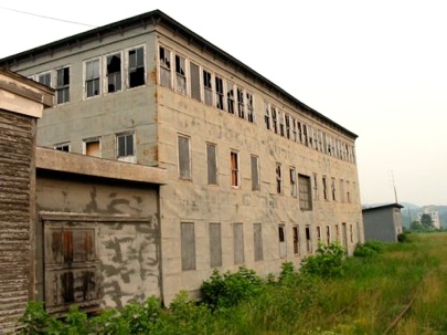
Look closely at the photo above and you will see CALDBECK-COSGROVE faded block lettering below the windows. For modeling, I don't have any actual dimensions, but I will estimate them based on the window castings I use. The NERAIL John Wallace photo to the left shows the building and its position relative to the E.T. & H.K. Ide building in January of 1992.
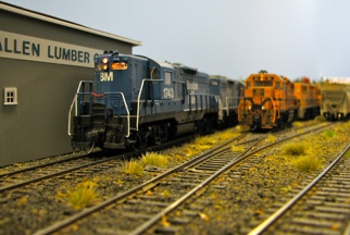
Allen Lumber Company
Another industry within the St. J yard area was the Allen Lumber Company. This building was along the same spur as the Ide and Caldbeck buildings, just south of them (you can see parts of them to the left). There were also tracks behind this building to serve other Allen Lumber out buildings (partially visible to the right). I do not have measurements for this building, but I estimated them based on pictures and factoring in the space I have available on the layout for this building. I have completed a model of this building. See my Structures page for more info.
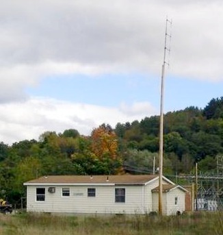
St. Johnsbury Yard Office
Next in line is this small yard office, constructed at some point by CP Rail. I'm not exactly sure when, but I'm pretty sure it was there in 1980. Bruce Grosser lives in the area and sent me photographs and measurements of the building (currently used by Washington County/Vermont Rail System). Here is the information he gathered for modeling the building:
-
•Length & width: 39.5' x 23.5'
-
•Height: 10' on sides, 13' at peak
-
•Bump out on South side: 4' x 16'
-
•Foundation: 24" concrete
-
•Siding: 9" clapboard
-
•Doors: 36" doors on north side and east side
-
•ADA ramp on east side
-
•Ramp details - 2" x 8" wood, 1.5" pipe railings
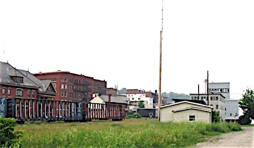
This view looks north and shows the line of buildings from the yard office up to E.T. & H.K. Ide. To the left, across the yard tracks, is the large passenger station (with gray roof) and a brick apartment building (neither will be modeled, they are in my aisle area).
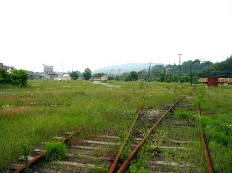
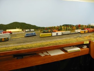
This view from the center of the yard area shows the buildings to the north and the expanse of yard tracks, now mostly covered by weeds (but they are there). To the right is the turntable which was still used right up to the end of CP operations in 1995. I don’t think VRS is using it currently.
Down in the southern part of the yard, off to the east a little bit, was a Ralston-Purina plant that was quite busy into the 1970s. I don't have room for this on my layout, unfortunately. It would be the source of some cars though if you can fit it in.
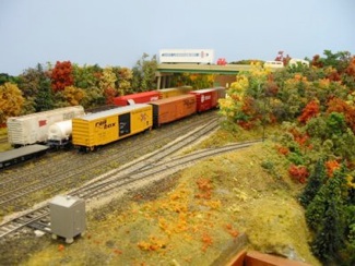
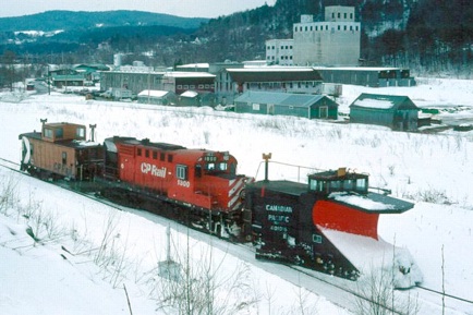
Past the Ralston Purina plant, the CP mainline heads out of the yard south towards Wells River. It is here that the Lamoille Valley (ex-St.J&LC trackage starts. This CP Plow extra is right over the switch that allows the LVRC to enter the CP yard.
Ralston-Purina Plant
LVRC track off CP Main
More Info on St. Johnsbury railroad operations
The May 2004 issue of Trains featured St. Johnsbury in the "Railroad Blueprint" series. There are a few factual errors and the map is not 100 percent correct, but it has good information and great photos by Ben Bachman. The following resources also have good information:
-
•St. Johnsbury & Lake Champlain - Philip R. hastings, May 1947 Trains, p. 50-59
-
•Today's Lamoille Valley (St. J. Saga Pt. 3) - May 1980 Railfan & Railroad, p. 26-37
-
•Loatti to Lamoille Valley (St. J. Saga Pt. 2) - March 1980 Railfan & Railroad, p. 48-55
-
•ST.J. & L.C. (St. J. Saga Pt. 1) - January 1980 Railfan & Railroad
-
•"Northeast Kingdom", B & M, CV and CP Pt. 2 - February 1982 Trains, p. 22-32
-
•"Railroad Blueprint", St. Johnsbury 1980 - May 2004 Trains, p. 52-57
-
•Book: Green Mountain Rails, Robert W. Jones, 1994
-
•Book: Maine Central Mountain Division, Ron Johnson, 1986
-
•Book: New England Rails 1948-1968, Morning Sun Books, 1989
-
•Book: New England's Colorful Railroads Vol. 1, Four Ways West, 2000
-
•Video: Red Alcos, Green Mountains - 60 min. color, 1995
Last Update: July 22, 2010
>> Back To Railroads main page